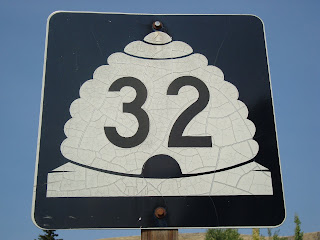
Posts

Showing posts from 2009

SR-138 and SR-112

Image
Over the weekend, K Jo and I went to visit my parents in EC so she could participate in the Little Grand Canyon half marathon. At packet pickup the day before the race, she asked a guy standing at a table if she could borrow his pen to fill out her registration form. She then did a double take, grinned sheepishly and blurted, "I read about you in my magazine". She recognized the man as Dane Rauschenberg ... see also here (you know you've made it when you have a Wikipedia article about you) who in 2006 ran 52 marathons in 52 weeks to raise money for the Mobile (Alabama) chapter of an organization called L'arche which benefits the mentally and physically disabled. He was featured in a running magazine that K Jo and I subscribe to and she recognized him from a photo in the magazine. He was in Price to run the half marathon that she was running and to promote and sign his book . I bought a copy and K Jo read about half of it aloud on the way home. I recommend i

SR-111

Image
We are headed to EC this weekend so K Jo can do another half marathon. She worked this morning and since I didn't really feel like leaving her alone at my parent's house, I did a ride this morning and headed to SR-111. SR-111 starts at SR-48 (New Bingham Higway). It heads slightly north for the first few miles curving to the north west and eventually heads straight north into Magna. Most of it is downhill and it ends at SR-201 after 10.6 miles. Along the way, it passes the junctions for SR-173 (5300 S) and SR-171 (4500 S). Pretty boring, huh? If I had to sum up this ride in one word, it would be disappointing. I started out my ride from my townhouse and headed to 7800 S which eventually turns into New Bingham Highway. When I hit SR-111 I took a picture of the cool end sign, which is different from all the signs I have seen before, and headed North. I was pretty excited about riding this one because I had ridden sections of this road South of SR-48 and it was a lot of fun to r

SR-32

Image
Monday was a day off for me and a work day for K Jo and I have been planning a long ride for a while... I am working towards a few goals, namely riding the LOTOJA and doing a Half-Ironman , so I decided on SR-32. SR-32 starts just north of Heber and heads pretty much straight north. It begins with a great warm-up by climbing around 1000 feet in about 4 miles. About halfway up the hill, there is an awesome view of Jordanelle Reservoir and it's dam. It then meanders East for a few more miles until the hill peaks then descends until a short steep climb into the small town of Francis where it meets SR-35 and takes an abrupt left and heads STRAIGHT north, never deviating, for around 6 miles. On the way, it undulates up and down through Kamas, where it meets SR-248, then SR-150 (mirror lake highway). It also parallels a nice little bike path for about a mile and a half just after you leave the town of Marion. The route continues on in a North-West direction through a few more small

I post this at my own peril...

Image
Remember my post about SR-67? The one about the Legacy Parkway? If not, it is the one right before this one... Anyway, there was a photographer there taking everybody's picture which is pretty standard for a racing event like this one. So Sunday after church, K Jo and I went on the website that was printed on the flier we were given to take a look at our pictures. We found hers first and... no surprise... she didn't like it. I thought she looked good, but she is... well, she just didn't like it. Then we looked up mine and Kathy Jo just about fell on the floor laughing... I laughed too, but I was also just a little disappointed... Okay, so here goes: Okay, go ahead and laugh... no, really, go ahead... I'll wait... Okay so if you didn't find it all that funny take a look at this one from the Salem Spring Triathlon I competed in on May 30th: Still don't get it? Okay one more picture. I took this one for an upcoming post about summer, fall/spring, winter bic

SR-67

Image
About two weeks ago, I helped some friends move from Logan to Ogden. On my way home, I saw a billboard advertising something about a half marathon and a bike tour on Legacy Parkway. I thought to myself... "I ought to tell Kathy Jo about that." After a few days of it rattling around in my brain, I finally got around to telling her about it. She got on our computer and yahooed (she yahoos rather than googles too) "half marathon legacy parkway" and came up with this website . She looked around a bit, saw that there was indeed a half marathon, a 20 mile bike ride and a 2 mile fun-run all on Legacy Parkway which would be shut down for the event. She decided that she would like to run this race. I asked her if she was sure (hoping that she was because I thought a ride like that would be cool) because she has another race only a week after this one, and she said yes... She WOULD like to run. I was pretty excited. Last year a co-worker told me that she had the op

Inadequacy...

Image
Okay, this isn't actually a state road ride entry, but it is still road riding so it's going on the blog. So Monday morning I was feeling pretty sorry for myself. I love my job and I like to think that I am pretty good at what I do (I work at Alta View Hospital in the laboratory) but I have A LOT of stuff that I have to do every night I work. Well, lately I have been trying to improve in some areas and it seems that when I get better in one area I start to slack in another. I also have kind of been neglecting Kathy Jo, because I have been sleeping a LOT when I get home from work and because it was the weekend, and she was home, she didn't get to see me... even though I was only in the next room (she REALLY has been a good sport about my work schedule this week). So... I felt bad about work, I felt bad about leaving Kathy Jo alone at night, and alone during the day, I feel bad about money, Kathy Jo's brothers stayed over the weekend (I really do love them but some

SR-48...ish

Image
SR-48 starts just west of the small town of Copperton at the gate for one of the roads leading to the Bingham Canyon Copper Mine. The road immediately climbs a short hill, then as you can see, descends for about ten miles. On the way it passes through the quaint little town of Copperton. Further down the road, it intersects SR-111 where it continues through acres and acres of farmland, and just before the first signs of civilization appear, it meets the start of SR-209. It then passes the south border of Salt Lake Municipal 2 Airport, and continues on down to cross SR-154 (Bangerter Hwy) where it finally meets SR-68 (Redwood Rd) at 7800 S. Then it ends... sort of... It actually continues on for another 2 miles, 1 mile north at 7000 S... I know, weird right. It doesn't follow Redwood, it just kind of skips... Anyway, it continues down until it crosses the Jordan River, then curves slightly south where it passes under I-15 then ends at US-89 (State St) in Midvale. The route is

Elevation Profiles!

Image
So I finally broke down and bought a GPS unit. Okay, okay, okay, I didn't really "break down"... I EAGERLY went online and bought a GPS unit. After intensive, scrutinizing, painful, obsessive minutes of research, I decided on a Garmin E-trex Vista HcX. I present it to you in all it's glory: AAAAAHHHHH! Okay, okay, so not that great, right? Well, it has a color screen and a high sensitive GPS sensor which is REALLY cool because you can still receive accurate guidance in slot canyons and under tree cover... (For those that don't know, GPS stands for Global Positioning System. There is a great article here about GPS that a does a WAY better job at explaining than I can. If you don't know much about GPS, or even if you do, check out the article) It also has a navigation system that can give turn by turn directions, and it has maps with roads and topographical data... But wait... there's more... It has an electronic compass and a barometric altimeter

SR-66

Image
So K Jo worked Friday morning and even though I signed up to help with morning rounds at TOSH, it was a very slow day, so I left after only an hour to bike while the wifey was at work. She had an appointment at Bingham Cyclery to have her bike fitted at 12:30 so I knew I didn't have much time... At this point, I feel like I should explain. TOSH is The Orthopedic Specialty Hospital. A hospital especially for people to have knee, elbow, hip, shoulder etc. operations. Morning rounds refers to lab work done every morning on said patients. Finally, a bike fitting is something you do when you buy a new bike. They set the bike in a trainer , and watch you pedal and then make adjustments to your shoes, seat post, saddle, handlebars, etc. to make sure that your bike fits your body in the best possible way. There is a really great article on utahmountainbiking.com for those who want to do bike fitting on their own... which is what I have to do since I can't afford to pay someo