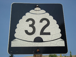
SR-32


 Monday was a day off for me and a work day for K Jo and I have been planning a long ride for a while... I am working towards a few goals, namely riding the LOTOJA and doing a Half-Ironman, so I decided on SR-32.
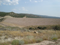
SR-32 starts just north of Heber and heads pretty much straight north. It begins with a great warm-up by climbing around 1000 feet in about 4 miles. About halfway up the hill, there is an awesome view of Jordanelle Reservoir and it's dam. It then meanders East for a few more miles until the hill peaks then descends until a short steep climb into the small town of Francis where it meets SR-35 and takes an abrupt left and heads STRAIGHT north, never deviating, for around 6 miles. On the way, it undulates up and down through Kamas, where it meets SR-248, then SR-150 (mirror lake highway). It also parallels a nice little bike path for about a mile and a half just after you leave the town of Marion. The route continues on in a North-West direction through a few more small farming communities, Oakley (where it starts descending) and Peoa. After Peoa, it continues down until it passes Rockport Reservoir held back by the Wanship dam where the road ends at I-80 just North-East of the town of Wanship, 29 miles.
I started off my Monday morning by getting ready for this ride. I filled my bottles, put my bike clothes in the car and but my bike on the trunk rack. I turned my car on, noticed I needed gas, and tried to start it... nothing... I tried again... again, nothing... The radio worked and so did the digital dashboard display, so I knew the battery was probably okay, maybe the starter but I couldn't very well fix my car in the garage, so I pushed it out of the garage backwards, put it in reverse and popped the clutch for a push start. First order of business was gas, so I drove to the gas station, filled up and went to start the car, hoping it was the battery or something less expensive, again... nothing. After push starting the car again, I called the Suzuki dealership and described my problem and also noticed the check engine light was on. The tech on the other end said it may be an alternator and the check engine light could be caused by low voltage and that I should bring it in. No ride for me today. I drove to K Jo's work to drop the bad news and she called her brother who is a wonder mechanic and he suggested taking it to Checker Auto to test the battery. "How fortuitous" I thought. "If it is the battery, it is still under warranty and I will get a new one." They tested the old battery, and found it in need of replacement. After upgrading to a better battery and installing it in the parking lot... nothing. The guy helping me happened to be out in the parking lot helping another customer and ran back into the store to retrieve a tool for just such an occasion. He stripped out the inside of the somewhat corroded battery cable, reattached and... voila! it started. Thanks Checker guy! I will forever be a battery customer of Checker Auto!
By this time, it was already 11:30, but I decided "To heck with it! I'm going riding!" I stopped first at Harmon's to buy some lunch (delicious sushi) and some GU. I decided to go all out and bought about $100 worth (of GU, not sushi) because K Jo and I both use it, so why not buy in bulk? I headed up I-80, passed Park City, down US-40 and parked my car just off the side of the road. I changed into my bike clothes, got out of the car and cursed my luck that I had picked a windy day to ride. I filled my pockets with GU, clif bars and a small bag of trail mix, took the bike off the car and started up what was sure to be a long hill. Half a mile into the hill, I started to get thirsty, and reached down to grab a water bottle only to realize I had left them in the car. I headed back down the hill, retrieved the bottles and started up again, cursing my luck again that the day was so windy. On "long hill take 2", I noticed the American flag flying in someone's yard just off the road was flying full, indicating a stiff wind from the south. Not a problem, in fact great, it will help me up the hill... until I come back and the wind will be in my face. I got to the Jordanelle Dam viewpoint, snapped some pics,

 and headed East up the hill. I finally got to the top, then started a short descent and even with a hard cross wind, I was cooking. After that, fighting the wind was tough all the way to Francis where I grunted up the short steep hill, hoping that I could somehow be done fighting the wind. I headed North, the wind at my back now, and rode the straight section without incident, and polished off one of my clif bars. After passing Peoa, I made my way down past Rockport Reservoir, into Wanship. Just past the reservoir, I checked my GPS to see how far I had come down and realized that I had been going down the whole time with the wind at my back. This did not sit well with me. I wasn't looking forward to riding uphill with the wind in my face. I crossed under I-80 and proceeded North East until the road again hits I-80. I searched in vain for an End sign and finally turned around at mile 29.3. Fighting the wind in 87 degree weather had all but exhausted my water supply, so I stopped at a gas station just off the freeway to refill... you get some interesting stares when you walk into a gas station with bike shorts on... After refueling, I started grimacing at the thought of climbing for the next few hours into a head wind. I started the grunt up the hill, sucking on a GU with two fresh bottles of ice water. I made my way past the dam, pausing for a moment to get some pics of the Wanship Dam and Rockport Reservoir.

 I climbed up to Peoa, and on into Oakley munching on my bag of trail mix the entire time... it is really hard to eat trail mix while riding a bike into the wind... In the middle of Oakley, I saw two deer in a yard off to the side of a house.
  I passed through Marion, and on into Kamas where I again filled the water bottles. Riding into a head wind in 90 degree weather is a lot harder than fighting a crosswind in 87 degree weather. I finally made it to Francis and got my first chance to descend that short steep hill, and the slight downhill grade that followed until... I had to go up, up, up... did I mention that I was fighting wind? At the top of that hill, I looked into the distance to see another hill. Despite that hill being short, I had 52 miles behind me and I was tired. I finally eeked over the top and now, despite a strong headwind, had the pleasure of descending the final four miles with minimal effort. I got back to my car, changed out of my bike clothes and headed into Orem to give my brother in law some of the GU I bought for his birthday (he is on the cross-country team at his high school). This day's ride was 58.6 miles. I rode for 3:29:08 averaging 16.7 (stupid wind) with a max speed of 47.3 mph. Total so far, 8 state roads, 249.5 miles total riding, 110.5 miles of state roads. Thanks again for reading!
Chris
ps... I also looked for an end sign at the beginning of the route, but couldn't find one there either, so instead of an end sign picture, you get a picture of my awesome helmet hair after three and a half hours of riding


Dude, that's some serious helmet hair.
ReplyDelete