Posts

Showing posts with the label Road Biking

SR-190

Image
Don't you hate it when you're riding your bike down a hill and all you can think is, "Go faster you stupid car."? I didn't actually think that on Tuesday (June 29th), I have before, but not then. I thought I would because I rode SR-190, aka Big Cottonwood Canyon which is a big... freaking... mountain... As the saying goes, what goes up must come down, I went up the mountain and so I HAD to come down the mountain... to the tune of wind screaming past my ears at over 50 mph... but only for a second or two. My average speed down the hill was probably closer to about 35 mph. You still get pretty good screamage at 35 mph. I had a pretty rough weekend... Work was crazy... I was busy attending a wedding reception and church, and I went home teaching. I have stuff going on at home that is UBER stressful that I won't go into now and Monday afternoon... I sliced my finger opening an envelope... that's right... an envelope. Monday night, I went to a movie w...

SR-152

Image
Today (June 13th) was the first day in almost a week since I have ridden. I have been following my half iron man training program, and last week was very swim intensive. I also took three days off. Anyway, today called for a 75 minute ride, so I decided to tack on SR-152 (aka Van Winkle Expressway) as part of my ride. 152 starts out at SR-71, about 900 E and 4800 S in Murray. It winds its way south east, up a small hill for 3 miles where it terminates at I-215 in Holladay. I, as per tradition, rode this route backwards (okay I don't have a "tradition" but it seems like the last few routes have all been backwards first). The route was kind of scary at first because it is signed at 50 mph and for the first half mile, there is no shoulder, and it interchanges with I-215. I did my best to avoid being plastered, and finally made it to 6100 S where an ENORMOUS shoulder opens up. Being an "expressway", I didn't think SR-152 would get much bike traffic, bu...

SR-151

Image
A few months ago K Jo was working on our computer when it crashed... and we lost EVERYTHING. Pictures, music, video game save files, you name it, it was gone. About a week prior to the crash, I had moved all of my state road data from my flash drive to my desktop and never got around to moving it back so I lost all of that too. Pictures, maps, elevation profiles and perhaps most devastating... the list. I spent hours on that list and now it was gone, SO I have once again been working on a list of all the state roads in Utah. This time I just decided to go for broke and make a list of all the state highways, including the ones shorter than 5 miles unlike I had previously planned . While working on the new list, I decided that hitting the short routes would not be too difficult, it would just require a lot of planning. So the other day (Friday June 4th) I headed out on a training ride and decided to add SR-151 (aka 10600 S, aka South Jordan Pkwy aka 10400 s). As I said before, t...

SR-248

Image
I know, I know it's been like seven months, but it was winter, and I THOUGHT I MIGHT ride some of southern Utah's highways, but K Jo and I started snowboarding and I started training for The Utah Half, and... Anyway here is my latest adventure on Utah's State Highways: SR-248. To sum up the whole ride, here is a picture: I love seeing flags when I ride because they are such great indicators of wind speed and direction. Yeah, that was my day... wind. I am picking up some shifts at Park City Medical Center so Saturday morning (May 22nd) I went there to become acquainted with the lab. I really didn't feel like driving all the way to Park City JUST to see the lab, so I decided to see what state roads were near Park City. Luckily, I found SR-248. I am in the middle of training for the Utah Half , and today I was supposed to ride two hours. How fortuitous that this road is 14.5 miles long with lots of hills meaning out and back would take two hours. The road starts at SR-224 ...

SR-138 and SR-112

Image
Over the weekend, K Jo and I went to visit my parents in EC so she could participate in the Little Grand Canyon half marathon. At packet pickup the day before the race, she asked a guy standing at a table if she could borrow his pen to fill out her registration form. She then did a double take, grinned sheepishly and blurted, "I read about you in my magazine". She recognized the man as Dane Rauschenberg ... see also here (you know you've made it when you have a Wikipedia article about you) who in 2006 ran 52 marathons in 52 weeks to raise money for the Mobile (Alabama) chapter of an organization called L'arche which benefits the mentally and physically disabled. He was featured in a running magazine that K Jo and I subscribe to and she recognized him from a photo in the magazine. He was in Price to run the half marathon that she was running and to promote and sign his book . I bought a copy and K Jo read about half of it aloud on the way home. I recommend i...

SR-111

Image
We are headed to EC this weekend so K Jo can do another half marathon. She worked this morning and since I didn't really feel like leaving her alone at my parent's house, I did a ride this morning and headed to SR-111. SR-111 starts at SR-48 (New Bingham Higway). It heads slightly north for the first few miles curving to the north west and eventually heads straight north into Magna. Most of it is downhill and it ends at SR-201 after 10.6 miles. Along the way, it passes the junctions for SR-173 (5300 S) and SR-171 (4500 S). Pretty boring, huh? If I had to sum up this ride in one word, it would be disappointing. I started out my ride from my townhouse and headed to 7800 S which eventually turns into New Bingham Highway. When I hit SR-111 I took a picture of the cool end sign, which is different from all the signs I have seen before, and headed North. I was pretty excited about riding this one because I had ridden sections of this road South of SR-48 and it was a lot of fun to r...

SR-32

Image
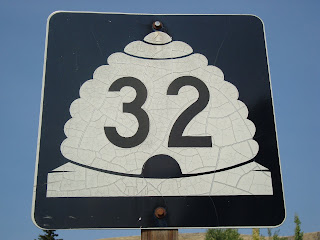
Monday was a day off for me and a work day for K Jo and I have been planning a long ride for a while... I am working towards a few goals, namely riding the LOTOJA and doing a Half-Ironman , so I decided on SR-32. SR-32 starts just north of Heber and heads pretty much straight north. It begins with a great warm-up by climbing around 1000 feet in about 4 miles. About halfway up the hill, there is an awesome view of Jordanelle Reservoir and it's dam. It then meanders East for a few more miles until the hill peaks then descends until a short steep climb into the small town of Francis where it meets SR-35 and takes an abrupt left and heads STRAIGHT north, never deviating, for around 6 miles. On the way, it undulates up and down through Kamas, where it meets SR-248, then SR-150 (mirror lake highway). It also parallels a nice little bike path for about a mile and a half just after you leave the town of Marion. The route continues on in a North-West direction through a few more small...