Posts

Showing posts from August, 2009

SR-67

Image
About two weeks ago, I helped some friends move from Logan to Ogden. On my way home, I saw a billboard advertising something about a half marathon and a bike tour on Legacy Parkway. I thought to myself... "I ought to tell Kathy Jo about that." After a few days of it rattling around in my brain, I finally got around to telling her about it. She got on our computer and yahooed (she yahoos rather than googles too) "half marathon legacy parkway" and came up with this website . She looked around a bit, saw that there was indeed a half marathon, a 20 mile bike ride and a 2 mile fun-run all on Legacy Parkway which would be shut down for the event. She decided that she would like to run this race. I asked her if she was sure (hoping that she was because I thought a ride like that would be cool) because she has another race only a week after this one, and she said yes... She WOULD like to run. I was pretty excited. Last year a co-worker told me that she had the op

Inadequacy...

Image
Okay, this isn't actually a state road ride entry, but it is still road riding so it's going on the blog. So Monday morning I was feeling pretty sorry for myself. I love my job and I like to think that I am pretty good at what I do (I work at Alta View Hospital in the laboratory) but I have A LOT of stuff that I have to do every night I work. Well, lately I have been trying to improve in some areas and it seems that when I get better in one area I start to slack in another. I also have kind of been neglecting Kathy Jo, because I have been sleeping a LOT when I get home from work and because it was the weekend, and she was home, she didn't get to see me... even though I was only in the next room (she REALLY has been a good sport about my work schedule this week). So... I felt bad about work, I felt bad about leaving Kathy Jo alone at night, and alone during the day, I feel bad about money, Kathy Jo's brothers stayed over the weekend (I really do love them but some

SR-48...ish

Image
SR-48 starts just west of the small town of Copperton at the gate for one of the roads leading to the Bingham Canyon Copper Mine. The road immediately climbs a short hill, then as you can see, descends for about ten miles. On the way it passes through the quaint little town of Copperton. Further down the road, it intersects SR-111 where it continues through acres and acres of farmland, and just before the first signs of civilization appear, it meets the start of SR-209. It then passes the south border of Salt Lake Municipal 2 Airport, and continues on down to cross SR-154 (Bangerter Hwy) where it finally meets SR-68 (Redwood Rd) at 7800 S. Then it ends... sort of... It actually continues on for another 2 miles, 1 mile north at 7000 S... I know, weird right. It doesn't follow Redwood, it just kind of skips... Anyway, it continues down until it crosses the Jordan River, then curves slightly south where it passes under I-15 then ends at US-89 (State St) in Midvale. The route is

Elevation Profiles!

Image
So I finally broke down and bought a GPS unit. Okay, okay, okay, I didn't really "break down"... I EAGERLY went online and bought a GPS unit. After intensive, scrutinizing, painful, obsessive minutes of research, I decided on a Garmin E-trex Vista HcX. I present it to you in all it's glory: AAAAAHHHHH! Okay, okay, so not that great, right? Well, it has a color screen and a high sensitive GPS sensor which is REALLY cool because you can still receive accurate guidance in slot canyons and under tree cover... (For those that don't know, GPS stands for Global Positioning System. There is a great article here about GPS that a does a WAY better job at explaining than I can. If you don't know much about GPS, or even if you do, check out the article) It also has a navigation system that can give turn by turn directions, and it has maps with roads and topographical data... But wait... there's more... It has an electronic compass and a barometric altimeter

SR-66

Image
So K Jo worked Friday morning and even though I signed up to help with morning rounds at TOSH, it was a very slow day, so I left after only an hour to bike while the wifey was at work. She had an appointment at Bingham Cyclery to have her bike fitted at 12:30 so I knew I didn't have much time... At this point, I feel like I should explain. TOSH is The Orthopedic Specialty Hospital. A hospital especially for people to have knee, elbow, hip, shoulder etc. operations. Morning rounds refers to lab work done every morning on said patients. Finally, a bike fitting is something you do when you buy a new bike. They set the bike in a trainer , and watch you pedal and then make adjustments to your shoes, seat post, saddle, handlebars, etc. to make sure that your bike fits your body in the best possible way. There is a really great article on utahmountainbiking.com for those who want to do bike fitting on their own... which is what I have to do since I can't afford to pay someo

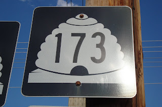
SR-173

Image
Before I start, I have a few things to say. 1: I HATE riding on sidewalks. They are bumpy, they have people on them, they have power poles to dodge, and glass and curbs and signs. Ugh, they are not fun to ride. There is nothing better than smooth asphalt for cruising. 2: There are a lot of very bike friendly roads in Utah... SR-173 is NOT one of those roads... I rode a lot on the sidewalks today. This highway starts at SR-111 just south of Magna about 5400 S. It shoots pretty much straight east. There are some pretty good gradual grades, not overly hilly, but not completely flat. On it's way east, it passes USANA Amphitheatre , West Ridge Golf Course, SR-172 (5600 W), SR-154 (Bangerter), I-215, Taylorsville High School, and SR-68 (Redwood Rd). From 56oo W to Redwood (about 4.5 miles), there is no shoulder and no bike lane, thus the sidewalk. The road continues on and passes the office of a GREAT dentist who happens to by my dentist, and a fan of this blog, Dr. Matthew B

The list is finally done

Image
So ever since my conception of this idea to ride all of Utah's highways, I have been working on a list. This morning, at work, I finished my list. I first looked at a map of Utah and got way overwhelmed. I then went to Wikipedia to figure out where and how many highways there are. I admit, I was WAY over overwhelmed. I started copying the info from Wikipedia into a word document so I could get these routes organized in my head and on paper. The info included S and W terminus, N and E terminus, distance and route number. The more info I transferred the more I realized that there are a lot of highways that are very short. I also read further on the article and found that 31 designated state highways serve state parks and institutions such as the University of Utah and Dixie State. Of those 31, only one is more than four miles long, SR-313 in Grand County that serves Dead Horse Point State Park . When I got into the hundreds and two hundreds, I got pretty tired of listing road that w

SR-29

Image
As I said in my last post, we were in EC at my parent's house for the weekend (Aug 1st) to play on Joe's Valley. They rented some wave runners for the day so I decided to ride up SR-29 which goes from SR-10 to just above the marina. I wanted to ride the whole length of the road so I headed N out of Caslte Dale to 29 and made a R towards 10. At the junction I snapped a photo of the "end" sign and turned around. This highway is lined with acres of farmland. Before entering the town of Orangeville, you pass Emery Animal Health on the right. The only reason I mention this is because my Mom is the receptionist/office manager here. I stopped here to fill up on water, then said hi to my mom and my wife who were there to clean my dog's teeth. After passing through Orangeville, you pass more farmland, cross SR-57, and get your first glimpses of Straight Canyon which climbs to the reservoir. Why they call it Straight Canyon, I will never know. It is not the least bit strai

SR-57

Image
This weekend, we are in EC with my family to play on Joe's Valley Reservoir so I decided to seize the opportunity and hit some of the roads down here. I had originally planned to do SR-155 with K Jo but she wasn't feeling well so we just went straight to Castle Dale. After being there for 10 minutes she said, "If you want to go on a ride somewhere, that is okay with me." I left as soon as I could and hit SR-57. Before I left, I told everyone that I was riding the Coal Haul Road. K Jo's eyes got as wide as saucers. She is always afraid I am going to get plowed over by some car. We explained to here that coal is no longer hauled from the Wilberg mine. My mom asked me if I was going all the way up. When I said yes, she said, "You are so weird." I smiled and took off. This one is fairly short at 10.7 miles. The milepost marking starts at the Wilberg Mine property and crosses SR-29, bypasses Orangeville before ending at SR-10. The Wilberg mine is th